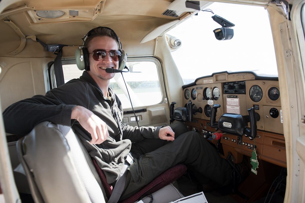
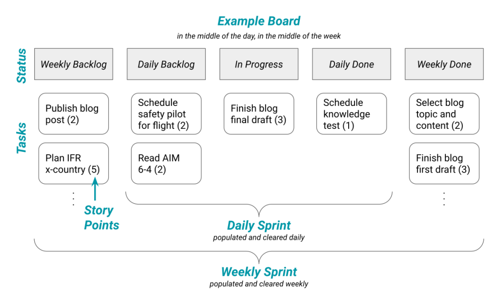
Stockton Metro Airport (KSCK) is my favorite training destination for a night cross-country because it regularly produces valuable situations I’d like a student to encounter.
I like it so much that even if a student trains at Palo Alto Airport (only 49 nm from Stockton),1 I will have them start with a relocation flight to San Carlos, then do their cross-country from San Carlos to Stockton and back to Palo Alto.
Interested to see what we’ll encounter? Join me on a typical night flight to Stockton!
What’s the Plan, Stan?
I prefer to divide night training into two flights. The first covers knowledge and night pattern work, and the second takes us on a night cross-country. Since we’ve already done one night flight, topics like fuel planning2 and personal flashlights3 should be familiar now.
Having decided our plan,4 I expect everything to be prepared and briefed (like any other cross-country). They’ll have reviewed the Chart Supplement for all airports and checked airport websites for any additional information. This is how they’ll know:
- San Carlos has specific noise limitations on pattern work late in the day,
- Stockton asks us not to overfly San Joaquin General Hospital and the city of Manteca,
- Stockton and San Carlos towers close at 9pm local time,
- only one runway at Stockton has lights,
- and so on…
With all that planning already complete, the student can preflight at sunset, and we can start the plane at civil dusk.
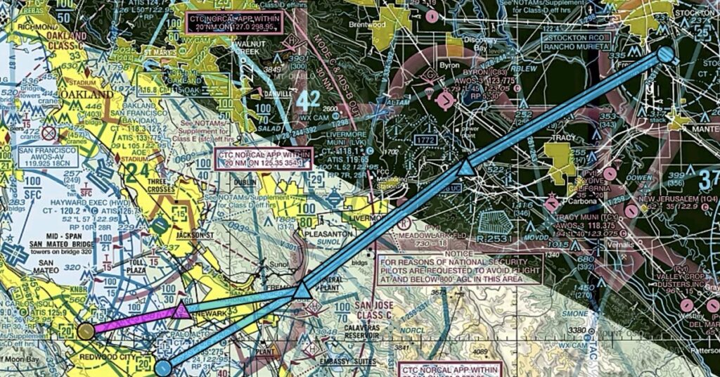
And We’re Off!5
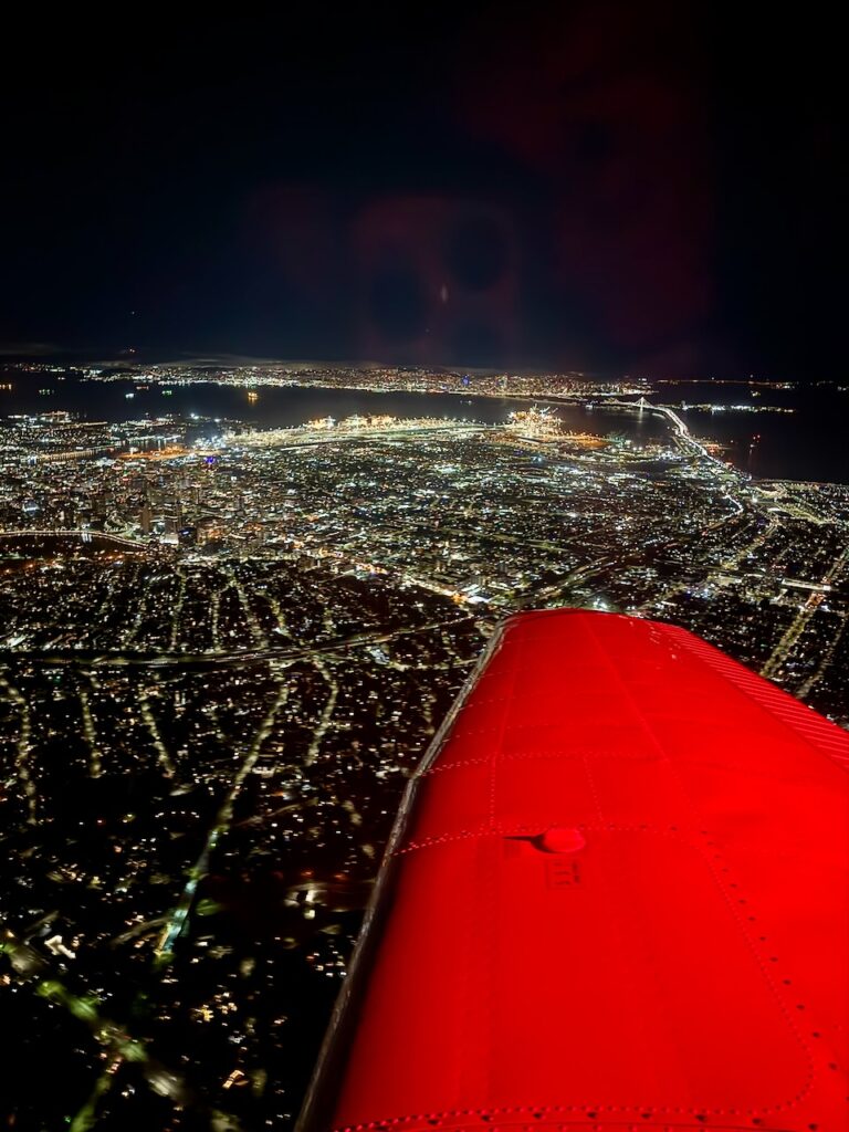
After a bit of probing into their preparation, we’re leaving San Carlos for our night flight. We discuss how, when the tower is open, they can turn the lights up or down for us. We also pick up flight following (a must around our busy airspace). With other planes’ nav lights6 and anti-collision lights at night, students easily find other aircraft. I like to use SFO arrivals to highlight how nav colors communicate direction of flight.7
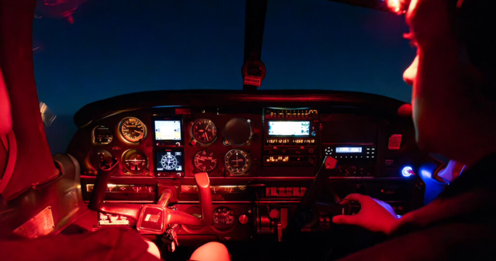
I’ll typically ask the student to use dead reckoning with a map and compass for the first part of this night flight. This highlights issues with flight deck organization and how chart colors look under red light.8 I try not to drag this out too long, though, just long enough to get an aha moment.
Mountains? What Mountains?
After crossing the Bay, we’re approaching Sunol Ridge. How well can you see the mountains? Will we clear the tops? Sometimes the peaks stand out with Livermore’s lights behind them, but the mountains to our south are nearly invisible. Even on a full moon night, you may see the ridges but be unable to judge their height. (It can be downright scary on a moonless night!)9 Ground lights can also create false horizons, which is another reason to cross-check our instruments.
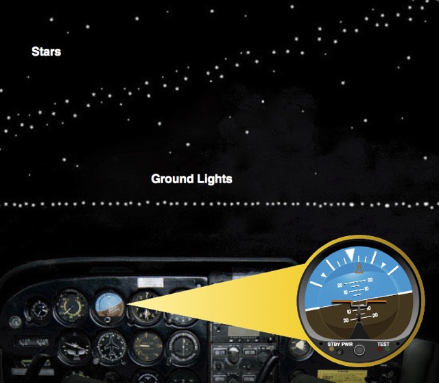
Speaking of lights, in the distance beyond Livermore, we see a field of blinking red lights. What are those? Where do they show up on your chart? How do you know an obstacle will be lit? Does the FAA notify us if the lights aren’t working? Hopefully they already know about the wind farms from their preflight, but seeing the whole hill light up in a synchronous red pulse is some mix of ominous and intimidating.
This naturally leads into a conversation about terrain awareness tools on ForeFlight or the GPS. It’s also a chance to discuss why we treat night flying more like instrument flying. There’s a good personal minimum related to this: consider taking on only one of mountains, IMC, or night at a time. And some pilots skip night flying entirely until they’re instrument-rated.
Please, Sir, I Want Some More (Altitude)
Continuing past Del Valle Dam, we discuss emergency landing options. In this area, it’s nearly impossible to see the terrain or the power lines. Wouldn’t it be nice to be able to glide to Livermore Airport? Could we?
If we were at 3,500′, a typical daytime altitude, we’d be about 3,000′ above Livermore and could glide ~4.5 nm. The airport is just about that far away, so we could maybe make it with a small margin for error. Could we climb to 5,500′, so that Livermore is a better option? This also kicks off a discussion about route selection. Perhaps going airport to airport at a higher altitude would make night flights less stressful.
Of course, higher altitudes have a big drawback for a night flight. Starting as low as 5,000′, the reduced oxygen means our night vision doesn’t work as well.10 I’ll sometimes bring a small O2 canister for students to try. It isn’t aviator’s oxygen, but it’s enough to show the impact.11
I Spy… a Place to Land
As we reach Altamont Pass,12 we’re back on the hunt for landing options.
The best-case scenario would be another airport! Can we find Tracy or Byron? Do they have a beacon, and can we see it? If not, perhaps we use our secondary radio to turn the lights on at the airport (while continuing to monitor TRACON with our primary radio). You might consider preloading the CTAF for any airports with pilot-controlled lighting in the standby radio while flying, so it’s ready in case of an emergency or diversion. Typically, I have the student find Byron Airport by turning the lights to full brightness,13 then use the sectional to locate Tracy Airport’s beacon relative to the highways and lights of Tracy city.
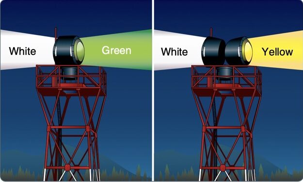
If we can’t glide to an airport, a major highway, such as I-5 just ahead, might work at night. Traffic is likely less of an issue; plus, you could flash your landing light as you get closer to get drivers’ attention. Smaller highways or roads are problematic for the same reasons as during the day.14
Finally, we talk about off-airport landings where there are no obvious options. In the Central Valley, we have many open fields. If you point to an area without terrain or lights, you might get lucky. Your sectional and preflight planning should help, but if you haven’t left yourself any good options, then… well, you may not have any.
There’s an old, morbid pilot joke: If you lose your engine at night, turn on your landing light to find a place to land. If you don’t like what you see, turn it off again.
Does Anybody Really Know Where Stockton Is?15
Getting into Stockton is often more like a diversion test case than a normal XC. For starters, if the student planned for 3,500′, our climb to 5,500′ means a new top of descent. The good news is we need to cross overhead anyway, since only one runway is lit at night, so a bit of extra altitude isn’t too problematic.
Finding the airport itself is trickier. We can reuse our Byron and Tracy techniques, but there’s a unique problem at Stockton. Just past the airport is an enormous and very well-lit train yard (BNSF Mariposa Yard). It is in the same direction as the airport, so cross-checking the GPS direction alone is misleading. Counting down the GPS distance, though, helps find the actual airport. It also helps to consider that runways are relatively dim to protect our night vision. The airport is probably a large, empty-looking area.
Goodnight Tower, Hello Helicopters
At this point, we’ve confirmed Stockton’s location using the beacon and maybe have the runway in sight. Now we need to get into the pattern.
- If the tower’s closed, we’ve been making radio calls the whole way in, and we’ll continue as we get onto the 45 and into the right traffic pattern for 29R.
- If the tower is open, we’ll establish two-way radio communications, and they often give us left downwind for 29R.
One other common experience at this point: the tower might close while we’re in the pattern. This is less exciting than it seems, with the tower essentially just saying goodnight and everyone switching to self-announce. Still, it’s nice to experience with an instructor.
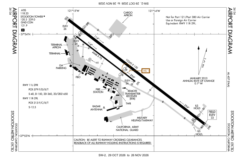
The actual traffic pattern is routine, although there are occasionally military or National Guard helicopters operating around the field. I’ve also seen military aircraft land on the unlit runway at night. This means a student needs to deal with wake turbulence concerns, as well as operations at landing pads around the airport that they may not have briefed. We talk about communication in these situations: you may need to ask other pilots in plain English what they’re going to do if you’re confused about their intentions. Confusion can be a big risk to your safety.
It’s also common to find other pilots doing night pattern work, which keeps things interesting. Since they’ll likely do stop-and-goes, where the aircraft completes a full stop on the runway before taking off again, we’ll need to give them more time to leave the runway.
“… Turning Final, Stop-and-Go, Stockton”
There are two big lighting issues at Stockton. The first is a strong black hole effect on final, just before the approach lighting system (ALS). This is a perfect opportunity to see the importance of using the PAPI. The second, in stark contrast, is that the ALS is blindingly bright at high intensity. Consider using only medium-intensity lighting or less while in the pattern, either by asking the tower or with 5 clicks on the CTAF.16 (And remember to retrigger the lights each downwind when it’s non-towered, so they don’t go out on you when you’re trying to land!)
Stockton’s 10,000′ runway makes stop-and-go landings easy. This complies with the full-stop landing requirement of night currency and private pilot night experience. This runway is also a good example of why we’re required to fly “with each landing involving a flight in the traffic pattern.”17 Without that limitation, Stockton is sufficiently long to take off and full-stop land multiple times in a row! But, at least as I understand it, the FAA wants some flight in the traffic pattern for each landing.
Depending on the student’s experience with night operations, I’ll often have them do a full stop and taxi back to see how navigating a big airport at night feels. We talk about using our landing light as we cross a runway and about what the various ground lights mean.
Last but not least, I would like every student to land once without a landing light. Stockton has a wide enough runway that there’s a margin for error, and most students are pleasantly surprised by how well they do. It’s also a good conversation point: landing lights are required equipment only when flown for hire,18 but you might insist on a functional one as a personal minimum.
Homeward Bound
On the way home, I try to keep it chill. Night flying can be quite relaxing if you’ve planned well. We do talk about ongoing emergency planning, but mostly I use the return trip to practice autopilot and let the student experience a calm night with a quiet TRACON frequency. (Why is that controller handing us off to themself on a different frequency?) Someday, maybe I’ll learn enough about constellations to tell stories on the way home. But honestly, by the time we’re returning, most students are happy to just look outside and enjoy the night.
Bonus Content: A 49 nm Problem
There are specific regulatory requirements for this night flight, and I’ll typically cover those with students when they learn about night regulations. I added them here for anyone interested.
When we first discuss this night flight, I’ll reference 14 CFR 61.109(a)(2)(i) as a reminder it needs to be a training flight, a cross-country flight, and over 100 nm total distance. Does KPAO-KSCK-KPAO count?19 Or KSQL-KSCK-KSQL?20 What about KPAO-KSCK-KSQL?21 Or KSQL-KSCK-KPAO?22
How could it be that KSQL-KSCK-KPAO counts, but the reverse route does not? I might lightly push on a student’s FAR knowledge here, although we’re quickly getting into the weeds.23
I do like to introduce the idea of a Letter of Interpretation at this point. While I don’t expect a private pilot student to read them, I’ve found this a nice introduction to the broader world of aviation laws and regulations. Some regulations are ambiguous, and this is how we can get clarity.
In this case, I’ll explain Van Zanen, 2009, which says “the pilot may choose what is considered a flight and what is merely a segment of a flight, and then log that flight time appropriately when the flight is conducted.” This means we can log a relocation flight from KPAO-KSQL, then a new logbook entry for the required night flight from KSQL-KSCK-KPAO, with KSQL as its original point of departure.24
There are many destinations that work for a night flight like this. Some are easier on the student, but I have yet to find one as consistently educational as Stockton.
Thanks for joining me on this flight!
Jack
- At only 49 nautical miles from KSCK, KPAO is too close to count toward the private pilot cross-country requirements. ↩︎
- When does the FBO close? Do we need to make a stop for self-serve? ↩︎
- Red headlamp, please! Also, the Plausibly Useful Idea of this post: red light is great for camping or looking around a car at night because it does not impair night vision. ↩︎
- See the Bonus Content section. ↩︎
- Like a dirty shirt! Or maybe more like a herd of turtles. ↩︎
- Green Red Dead ↩︎
- I also like to mention Operation Lights On (AIM 4-3-24), although they’re probably already familiar. ↩︎
- Yellow highlighter to make a planned route pop doesn’t work well under red light. ↩︎
- This is one of the reasons night fly-outs often fall during a full moon. ↩︎
- AIM 8-1-2 ↩︎
- Perhaps this would be a good time to try a proper oxygen tank out, although that always felt like one too many new things. ↩︎
- Also visible on the sectional near here is the Altamont Speedway, which has a more interesting history than I expected. ↩︎
- After confirming there’s no one in the pattern, so we don’t blind them. ↩︎
- Namely, hard to see signs and power lines. ↩︎
- 🎶 Does anybody really care? 🎶 ↩︎
- AIM 2-1-8 ↩︎
- 14 CFR 61.109(a)(2)(ii) ↩︎
- 14 CFR 91.205(c)(4) ↩︎
- Not XC (49 nm) and too short point-to-point (98 nm). ↩︎
- It does! (53 nm and 107 nm total) ↩︎
- Not XC (49 nm), but long enough (102 nm). ↩︎
- It does! (53 nm and 102 nm total) ↩︎
- What does 14 CFR 61.1(b) say about cross-country time? What counts as our original point of departure? ↩︎
- Note that this must be a new logbook entry; otherwise, your point of origin would still be KPAO. ↩︎